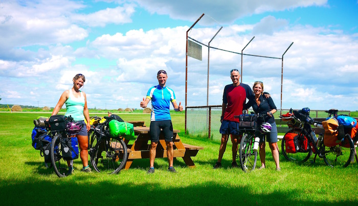
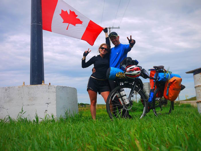
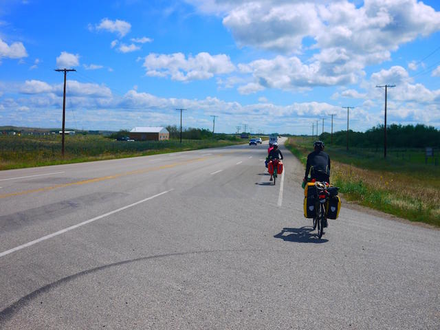
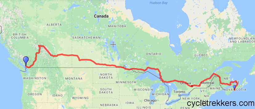
Cycling Lake Superior in Ontario

Ontario by bicycle. about us

Kelly’s write up of cycling Lake Superior! Click here to read Michael’s write up of biking Ontario.

Lake Superior is friggin’ huge!

Cycling Lake Superior was one of the highlights of our cycle trip across Canada. It’s the largest freshwater lake in the world, and has some stunning national and provincial parks, and I’m sure some amazing hiking. We spent 10 days cycling Lake Superior. We cycled 7000km and only covered about a third of the entire route around the lake. To put things in perspective, 700km is like a return trip from London to Paris.

The day we left Thunder Bay and headed north to Nipigon it rained. On top of this we had a terrible head wind, there were construction work for about 60km and there was next to no hard shoulder, which meant we were pretty much cycling in the road of a busy highway. It was not fun! And, it didn’t feel particularly safe. We had our lights on the whole time, but still I’m not sure we were that visible. The issue was, we had nowhere to get off the road, and so we had to keep going. 110km later and we finally rolled into Nipigon at around 8pm. The raining was still not letting up. We decided to screw the camping, and treat ourselves to a motel.

As it turned out, earlier that morning, before the rain started, Michael found an iphone on the side of the road. As luck had it we were able to return the phone to the owner. And, he gave us a $60 reward. That reward would be our cheap motel, which was actually pretty expensive for a motel ($90 – that’s our budget for 3 days), but the owner did give us a huge thermos of coffee and we managed to dry all our gear out.

Cycling Lake Superior
Beautiful (but cold) Lake Superior

We woke the following day to find the rain had stopped and the sun was making an appearance – woohoo!

After we had finally packed up, it was already a late start, but we decided to check out the town and grab a coffee. When we finally started cycling Lake Superior that day it was almost lunch time. The ride from Nipigon to Marathon was supposed to be hilly, but also very scenic. Straight away I realise we underestimated just how hilly this section would be.

The previous day we were shivering in the rain, today we were sweating, climbing up hills in direct sun. The kilometres were slowly clocking up. We had planned to do about 90km that day, but only managed 75km, and by the end of the day we were knackered. That night we camped at a picnic spot, right on the lake. It was one of the best spots we had camped all trip.

We took the following 2 days cycling to Marathon fairly easy. Allowing ourselves time to stop and enjoy the views and also not to burn out. The ride was challenging, but the scenery made the blood, sweat and tears all worth it. For me, cycling this section of Lake Superior was more difficult than cycling in the Rockies. Finally we made it to Marathon, and stayed with a local guy, Lloyd.

From Marathon the cycle got easier – or we got used to cycling steep gradients.

It felt like we flew to White River, and we arrived nice and earlier. Enough time to chill, have a shower, relax and eat a shit load of food. Apparently there had been a lot of bear sightings, so we were on extra alert. I was sure we would see a bear at some point around Lake Superior – we never did.

The next day cycling was just as good, and we arrived at Wawa at a reasonable time. In Wawa we meet a guy, Zoltan, outside the supermarket who invited us to camp in his garden. He actually ended up going the extra mile and setting up his trailer tent for us to stay in. The generosity of people during the cycle trip, never fails to amazing. People are genuinely amazing! Anyone that thinks otherwise should hop on a bike and go on a cycle tour – within a couple of weeks I can guarantee you would have experienced unbelievable hospitality and kindness from strangers.

Cycling Lake Superior Provincial Park

Cycling Lake Superior Provincial Park was one of the highlights of our cycle across Canada. It is definitely up there with Bow Lake and Banff National Park. We took our time cycling through the park to enjoy the beaches and vistas. One night we camped at Sinclair Cove – it looked like we were on a tropical island paradise. It has to be one of my favourite campsites (though I write this while we’re camped at a picnic spot, next to a stinky drop toilet).

I had to keep reminding myself that it was a lake and not an ocean. I love the ocean and often miss it when I’m travelling. What I’ve discovered is how awesome lakes can be – swimming in a lake feels refreshing like a cold bath, you can drink the water, it doesn’t sting your eyes and there are no sharks.

[ctt template=”8″ link=”mKHT6″ via=”yes” nofollow=”yes”]I had to keep reminding myself that it was a lake and not an ocean [/ctt]

We only had 2 days left of cycling Lake Superior before we reached Sault St Marie, and finally got a rest day off the bikes. I had been told there was a steep incline into Sault. Other than that it should be pretty easy going. We decided to take it easy and set up camp on the beach to enjoy the sunset. We got chatting to some people, and a local told us we would get moved on if we camped on the beach in this area. Complete bumper! Ian, the owner of a local RV park, came to our rescue, and let us camp in his RV park for free. This is just another example of the unbelievable kindness from strangers that we experienced throughout the cycle tour.

Cycling Lake Superior
Chilling out for a couple of hours on one of the beaches on Lake Superior

Sault St Marie

Finally after almost 2 weeks we made it to Sault St Marie, where 2 amazing warmshowers’ hosts, Juanita and Jeff, greeted us. We spent a couple of night exchanging stories, drying out and cleaning our gear and recovering, and eating some amazing meals, with our awesome hosts.

There is a bike store in Sault, called Velorution that has a free campground for cyclists. We decided, we had to spend at least one night at this campground. Unfortunately, there were no other cyclists staying there the same night as us. We’re in the tail-end of cyclists crossing Canada, so we tend to miss most of the cyclists, but it was still an awesome set up, and we were thankful for the extra rest day.

Already it has been over 2 weeks cycling through Ontario, and we still have 850km before we reach Canada’s capital, Ottawa. That means we would have cycled over 2000km in just Ontario. Ontario is just crazy big!

If you’re planning a cycle trip, you might find cycle tourists’ non training plan handy!

onwards to ottawa
Campsite at the bike store in Sault St Marie, Ontario

[ctt template=”8″ link=”k5Srw” via=”yes” nofollow=”yes”]Ontario is just crazy big![/ctt]

Cycling Ontario: To Thunder Bay

Cycling Ontario BRODIE CIRCUIT 2015

Kelly’s write up of cycling Ontario to Thunder Bay. Click here to check out Michael’s write up of biking through Ontario.

Cycling Ontario and it’s Lake-lands

Originally we had planned to dip into the USA and cycle the south side of Lake Superior. We had heard several horror stories about cycling Ontario, particularly the roads between Winnipeg and Thunder Bay, and though we’ve probably cycled worse roads in Iran and the Stans, we didn’t see the point in putting ourselves at unnecessary risk, especially when there were alternatives. So we headed to the USA border on highway 12 saying “goodbye” to Manitoba and the Prairies.

Highway 12 turned into highway 11 as we crossed into Minnesota in the USA. We followed this highway for 60km through the USA and back into Canada. The ride in the USA was absolutely horrible. It was 60km of hell, complete with thunderstorms, an extremely busy road and a hard shoulder with a rumble strip right down the middle, forcing us to cycle in the busy road.

Finally we made it back into Canada and started cycling Ontario! The road conditions immediately improved, and we couldn’t have been happier to be back.

[ctt template=”8″ link=”6M8sc” via=”yes” nofollow=”yes”]We couldn’t have been happier to be back![/ctt]

Canada Won the Toss

The plan was to follow highway 11 through Ontario from Rainy River to Fort Frances (which was only a hundred odd km), then head back south into the USA, however our plans changed once we got a message from our German cyclists friends, Luisa and Jacque. They were also heading to Fort Frances, so we arranged to meet up at the campground. We caught up on stories, over what turned out to be Canada’s most expensive beer. They told us they were planning on taking highway 11 to Thunder Bay after locals told them that highway 17 was really dangerous. Michael and I looked at each, found a quarter and flipped on what to do. Heads go through the USA, tails (or I think it was a moose head) stay in Canada. It was the moose head! We were staying in Canada. Bring on cycling Ontario!

I learnt that the route we were following was known as “Mom’s Way” – the alternative route from Winnipeg to Thunder Bay, which (strangely) included the 60km stretch through the USA. It was a lot quieter, with less services than the more popular and direct route to Thunder Bay.

ontario by bicycle
Pretty obvious… exploring Ontario by bicycle!

Cycling with Friends

Surprisingly, though we have done a cycle tour before, Michael and I have not cycled with our cycle tourists that often (well it’s been twice, with the same people), so to cycle with other people was definitely a new and exciting experience for us. Unfortunately for us, Lusia and Jacque had been cycling about 8 weeks longer than us, and have covered a lot more distance, which meant we were the slower cyclists (mainly me being the slowest – which isn’t always fun). On top of that, my knee was starting to ache. However, it was still enjoyable cycling with others and time spent in the saddle definitely went a lot quicker. Hopefully, we’ll get the chance to cycle with others cyclists again (hint to any cyclists out there on our route).

The “Mom’s Way” route

The cycling Ontario from Fort Frances to Thunder Bay was enjoyable. The first night we spent on a First Nation’s reserve at Seine River. The locals were really friendly and even opened up the community centre to let us use the showers and fill up our water bottles. The second night we spent next to a lake, which meant we all got cold baths before bed. This is where Jacque taught us his trick of hiding his food bag in the (bear proof) bins, so the bears couldn’t get at it.

The last night to Thunder Bay was spent next to an ice cream van. We managed to cycle 115km in the heat, humidity and storms, and arrived at Shabaqua Junction hoping to find somewhere to camp. We found that, plus more! An ice cream van, complete with a cool chillout area was there to greet us. It was the perfect end to the day!

Camping at the First Nations reserve

Lesson Learnt: Don’t drink and then set up the tent

Michael being the alcoholic that he is pulled then out a bottle of rum. I was feeling it after just one rum and ginger beer – and we still had to set up the tent and cook dinner. We somehow managed to do all this just in time for a huge thunderstorm to hit. This is when we learnt that we should not drink before setting up the tent – we set the tent up pretty wonky, and unfortunately we did get a bit wet!

After surviving the storm, we woke up in a rather wet tent. We decided to cycle 500m to a gas station and make breakfast there. Unfortunately, the gas station owners were jerks, but we did meet another cycle tourist, called Mike, who was also heading to Thunder Bay. It turned out he was also going to be staying with the same warmshowers’ host (5 cyclists in 1 warmshowers’ house – I hope he’s got a big house). Mike told us he started in Vancouver 3 weeks early, and was cycling something ridiculous like 150-200km. Personally, I can’t understand why you would even want to cycle that much – I don’t know how you would see anything along the way, and it must be so boring spending so many hours on the bike by yourself. You may as well just be driving or catch a plane. Anyway, each to their own!

So, we were on our way, all 5 of us stinky cyclists, heading to Thunder Bay – that last about an hour before Mike decided to zip on ahead to meet someone for lunch.

[ctt template=”8″ link=”4Tbm7″ via=”yes” nofollow=”yes”]We were on our way all 5 of us stinky cyclists heading to Thunder Bay [/ctt]

Thunder Bay

We stopped at Kakabeka falls along the way, and strolled into Thunder Bay just after 3pm. It was hectic! Thunder Bay was the biggest and busiest city we had been in since Regina, and it was safe to say we were no longer use to so much traffic.

We decided to stop in at Walmart, and then stop in at McDonalds (the German couple had somehow managed to score a $100 gift card for McDonalds, for free, from one of the owners). They kindly shouted us to a hot drink and treat. After that we headed to our warmshowers’ house, to meet our host, Frank. We had a great couple of days relaxing in Thunder Bay, and started to feel somewhat clean and normal, again.

Personally, I wasn’t overly impressed with Thunder Bay. It didn’t have a good vibe about it, and we didn’t find it particularly nice to cycle around. It did however have one of the most amazing dinner buffets EVER! Tokyo House – a Japanese buffet, only you order off the menu and they make it fresh for you. It was great! It was probably the best thing about Thunder Bay! Persians – a sweet kind of donut with pink icing topping, are also pretty good. Definitely worth trying if you happen to be in Thunder Bay.

After a few rest days in Thunder Bay, we said ‘goodbye’ to our host and our cyclist friends. They had decided to catch the bus for the next section of their trip. So, we hit the road, just the two of us and our bikes, ready to explore Lake Superior and continue cycling Ontario.

Are you planning your own self supported cycle tour? Check out this article about how to make money while cycle touring.

cycle tourists manitoba, Cycling Ontario
Our German cyclists friends – having lunch just after crossing into Manitoba

Cycling in Manitoba. New Province, More Prairies!

cycle tourist

Kelly’s write about about cycling in Manitoba. Click here to read Michael’s write up about biking in Manitoba.

Cycling in Manitoba

As we entered Manitoba the roads went from bad to worst! The hard shoulder disappeared and was replaced with a soft shoulder (or gravelly road that cannot be cycled). This meant while cycling in Manitoba we were forced to ride in the road. Luckily, the roads were relatively quiet and the drivers were very polite and would tend to get right over in the next lane when passing.

Just the two of us…

We had another great day of cycling with a strong tailwind! Luisa and Jacque cycled with us for the day. The four of us managed to smash out 85km by lunchtime. After lunch we said “goodbye” and headed our separate ways. Lusia and Jacque were headed to Winnipeg, where they thought they might catch a bus from, and we had decided to bypass the city and head towards the USA border in the south east of Manitoba.

Originally, we thought we would cycle the south side of Lake Superior, which would mean cycling through the USA for a couple of weeks. We came up with this plan based on several recommendations from other cyclists and because we had heard horror stories about the highways between Winnipeg and Thunder Bay in Canada.

cycle tourists manitoba, cycling in manitoba
Our German cyclists friends – having lunch just after crossing into Manitoba

Country Town Festivals

Hartney was the next town we were passing through, and we needed to stop for supplies (ie. food). The town looked like a ghost town! We headed to the grocery store and got chatting with some locals. Apparently the town had it’s annual weekend festival, and the locals we spoke to convinced us to camp at the local campsite and join them at the festival.

The festival was cute and the locals were super friendly. We joined them for some beers, watched the fireworks then headed back to the campground. Little did we know the campground would turn into a nightclub in just a couple of hours. Teenagers were up until about 4am making a racket, breaking into the pool and just being super loud. So, we didn’t get much sleep! We discovered that it was an annual tradition – we just wish we knew that before we decided to camp there.

The next day was pretty much a write off, though we did manage to cycle 90km and made it to the tiny town of Belmont. When we arrived we headed to the town campsite (surprisingly, most towns in the Prairies had a town campsite with facilities). We then discovered it was Belmont’s town festival! Not wanting a repeat of the night before, we took up an offer of a local that said we could camp in her garden. We had a great night sleep and even woke to homemade banana bread – people are awesome!

elgin manitoba, cycle touring videos, cycling in manitoba
Love this buildings in the towns we cycled through in Manitoba

Mennonites and Hutterites

We still had a little way to go before our planned rest day at a farm near Morris (100km south of Winnipeg). I had arranged for us to stay with a couchsurfer (Jordan) there. Originally we were only going to stay 1 night, but ended up staying 2, which gave us enough time to clean the bikes, our gear and ourselves, as well as hang out with Jordan. Jordan was awesome! He taught us loads about Mennonites, and the Christianity religion common in the area. We even got to visit a Hutterite community.

If you’re not familiar with Hutterites (or Mennonites for that matter), they are similar to the Amish in the USA. Like the Amish, Hutterites have their own communities. Simply put (and how it was explained to me) the biggest differences between the 3 Christian types; Mennonites don’t agree with violence and don’t live in communities like the Amish and Hutterites. The Amish don’t agree with modern technology, so live in communities that are completely cut off from the modern world. And, the Hutterites believe in living in common (kind of like communism), so everyone is equal, and they also live in communities, though they do use modern technology, but everything they have must have a purpose and be practical. There are different degrees of conservativeness in each group.

Visiting the Hutterite Community

The hutterite community we visited was quite conservative. We were shown around the community by some of the schoolgirls. They wore homemade clothes, with shawls or bonnets. Hutterites even speak their own language, which is a German delict. They also pray in High German, but are taught in English. This meant they had a very distinctive accent. The community was super modern and was made up of about 120 people (approx. 17 families). They had a commercial hatchery for eggs and a dairy farm, beehives, vegetable garden and grew wheat, and were practically self-sustained. They also had their own school. If a Hutterite wanted to leave the community to visit family in another community then they would have to get permission from the Minister. If they needed to visit the doctor or buy something, they would need the minister’s permission. Everyone had a job, which was assigned to you.

Though this all may sound quite restrictive, at the same time, they never had to worry about unemployment or poverty. I don’t think I could live in a community like that, but it works, and it is sustainable, and the people lived good, happy lives. It was an extremely interesting experience. Unfortunately, we weren’t allowed to take any photos, so I can’t show you what it was like, but if you get the opportunity to visit one, I highly recommend it. This is definitely something you’re more likely to experience cycling in Manitoba, opposed to driving through in a car.

Flying the high life

After visiting the Hutterites Jordan took us for a flight in is Dad’s plane – yep, we flew in a plane. Not exactly eco-friendly, but it would have been rude to decline. The wind was quite strong, which made for a bumpy ride, but we got to see for ourselves just how flat the Prairies were.

view from plane canada manitoba
The view from Jordan’s plane – you can see how flat the Prairies are!

Friendly People

The next day it was time to hit the road again! We planned to make it 2 the US border in only 2 days, so we still had a few hundred kilometres of cycling in Manitoba. The first night we spent in the cute town, Vita, where we were greeted by more friendly people and a really good café and grocery store. If I could sum up Manitoba in one word, it would be “friendly” and funny enough, that’s what it said on the “welcome to Manitoba sign” and even on their car registration plates. The people most definitely live up to that expectation.

Tornado?!?

That night we camped at a school, under a shelter as we heard there was a bad storm coming. The storm was terrible! Hail, strong winds, rain, you name it we had it. Jordan had told us when you hear a tornado coming; you will hear a noise like a train speeding pass. We heard cycling in Manitoba could be a challenge, but we didn’t think tornado warnings would be apart of that. That night while we were camping, we heard a train, only there was no trainline anywhere near Vita. After about an hour or so of terrible weather, it suddenly went completely silent. It was an eerie silence. We never found out whether a tornado did touch down that night, but it was definitely one of the worst storms we had ever camped in.

Goodbye Prairies – you’ve been fun!

For the rest of the day we cycled to the US border, with the plan to camp as close to the border crossing as possible. The terrain had already started to change. We could tell we were leaving the Prairies and coming to an end of cycling in Manitoba. We managed to camp only 5km from the border crossing.

[ctt template=”8″ link=”UdS72″ via=”yes” nofollow=”yes”]Goodbye Prairies – you’ve been fun![/ctt]

Throughout the Prairies, I spent a lot of time staring at a grain elevator in a distant town. I wondering whether we’re ever going to reach this town, or whether I’m actually hallucinating. You really feel the distant on the straight flat roads, and a lot of the time you feel the strong winds too. I think these are the main reasons why many cyclists dislike the Prairies. However, they are still quite beautiful, with beautiful people and beautiful towns. So, though the Prairies go on and on, don’t skip out on cycling in Manitoba or Saskatchewan! That’s over 1000km of Canada you’ll be missing, along with some amazing people and beautiful, but challenging landscape.

Are you about to finish a long term cycle tour? Or changing to a different style of travel? Check out our article on the transition from cyclist to backpacker to see what to expect.

Pedalling the Prairies: Swift Current to Manitoba

pedalling the Prairies

Kelly’s write up of pedalling the Prairies during our cycle tour across Canada in the summer of 2016. Click here to read Michael’s write up about cycling in the Prairies.

Pedalling the Prairies of Saskatchewan

While pedalling the Prairies we discovered friendly people, good campsites and great cafes. We also discovered that the Prairies went on and on, and on. from Swift Current we got on the Trans-Canada highway 1. It felt like a dream after spending a week cycling through the bumpy roads of the forgotten Prairie lands. The section of highway between Swift Current and Moose Jaw had a wide, smooth hard shoulder. It even felt like we were on a slight descent, though I’m sure we probably weren’t. We were smashing out the kilometres! It felt great! On top of this there were plenty of cute towns to stop at. All of them had a museum, coffee shop and free wifi. We were in cyclist heaven!

We spent an enjoyable couple of days cycling to Moose Jaw. Spending too much time at the various towns and cafes along the way.

One thing I noticed about Saskatchewan is the interesting town names. We visited Kyle and Herbert, and seen signs for Elbow, Eyebrow and Cereal. Moose Jaw and Antler also got a visit from us. I can’t help but be intrigued to how a town got a name like Eyebrow – at least it gives you something to ponder while on the bike.

[ctt template=”8″ link=”1xzLX” via=”yes” nofollow=”yes”] I can’t help but be intrigued to how a town got a name like Eyebrow[/ctt]

Warmshowers’ and Prairie Hospitality

Once in Moose Jaw we were greeted with the lovely Glenda, a legendary warmshowers’ host. This was followed by a few nights stay in Regina with Ron, another legendary warmshowers’ host. And then yet another warmshowers’ host in Sedley and an offer in Arcola.

People tend to give Saskatchewan and the Prairies (in general) a hard time! We were told numerous times to skip the Prairies; that they were boring and had nothing worth seeing. Well, what I have to say to those people: if you want to see boring head to Western Australia and drive 5 hours east – red sandy desert for days. You’ll be lucky if you even pass a gas station or see another person!

The Prairies on the other hand are fully of extremely friendly people, all whom have an interesting story to share. We met ranchers, famers, Mennonites and Hutterites, Germans, British, Ukrainian people, plenty of cyclists and people enthusiastic about cycling, and just a whole bunch of awesome people. In fact, I don’t remember one person that I met in the Prairies that wasn’t amazing in one way or another. For me, a large part of travelling and cycle touring is the people you meet, and we met some amazing people in the Prairies.

regina, cycling the prairies
With our amazing host in Regina!

Rest Days in Regina

We decided to have a few rest days in Regina. There were a couple of reasons for that, firstly for Ron’s amazing cooking, secondly to get a few bike things sorted, and thirdly to sort out my eye! 6 weeks (since the day we arrived in Canada) and I still had an infection on my eyelid. Obviously, at this point I was a little concerned about it and decided it was a good chance to get it checked out. I was told some good and bad news. The good news was it didn’t look like a virus so it shouldn’t spread to my eye and affect my eyesight. The bad news, it will still take some more time to heal and potentially I could have a bump on my eye for the rest of my life. At least I didn’t have too much to worry about!

After Regina we planned to get off the highway and head onto some quieter roads through some smaller towns. Usually the roads weren’t as good, but they were quieter. We also got the opportunity to pass through less travelled areas, which we always preferred.

Cycling through Canada’s Tornado Alley

One thing we hadn’t considered to be an issue or concern while pedalling the Prairies, were tornados! To be perfectly honest, I didn’t even know Canada got tornados, so when I received an email from Brad (another warmshowers’ connection) about a tornado warning in the town we had planned to camp in that night, we were a bit concerned. The day had already been struggle, with 60kph+ headwinds we were at times barely cycling 8kph.

We pulled into Fillmore at 1pm for lunch and pretty much passed out from exhaustion and defeat. After lunch we headed to the town hall. This is when we discovered the tornado warning! The lovely people of Fillmore came to the rescue. Before we knew it we had a basement to sleep in and was being shown around the local towns. The random kindness of strangers never fails to amaze. It really does restore your faith in humanity.

[ctt template=”8″ link=”3TJQ0″ via=”yes” nofollow=”yes”]The random kindness of strangers never fails to amaze.[/ctt]

After a goodnight sleep, out of the danger of any potential tornado or hailstorm, we were back on the way. And, for once, the wind was at our backs! We were practically flying down the road towards the next province, Manitoba.

Saskatchewan, pedalling the prairies
Friendly hosts in Saskatchewan!

Making Cycle Touring Friends

We had just passed Stoughton (where we were supposed to camp and where apparently a tornado did touch down the night before), when we heard some strange noises behind us. As it turned out, a German, cyclist couple, Luisa and Jacque had been following us for a few days. They finally managed to catch up with us. They were the first couple we had ever cycled with, so it made a nice change to cycling just the two of us. So all four of us continued pedalling the Prairies together.

We spent the rest of the day, cycling with an unbelievable tailwind and made it 137km to Redvers, right near the Saskatchewan/ Manitoba border. Redver’s had an awesome (and cheap) campsite, so we decided to camp there for the night and celebrate with a few beers.

After 2 weeks pedalling the Prairies of Saskatchewan we finally got to cross into the next province, Manitoba.

Though Manitoba would be a new province, we still had a few hundred kilometres of cycling through the Prairies before we would be out of the pastures and meadows and into the lakelands of Ontario.

Planning your own cycle trip? Don’t forget to buy insurance! Check out this article to find out why it’s important to get sufficient cover on your trip.

pedalling the prairies
Jacque, Luisa, Me and Michael having lunch somewhere in the Prairies!

Cycling in the Saskatchewan Prairies of Canada

Cycling in the Saskatchewan Prairies

Kelly’s write up about cycling in the Saskatchewan Prairies during our coast to coast cycle trip. Click here to read Michael’s blog post about cycling the Prairies.

Hello Saskatchewan!

Cycling in the Saskatchewan Prairies.

As soon as we crossed into Saskatchewan there was an instant change in road quality. No more wide hard shoulder and lots of potholes. The only things that stayed the same were the swarms of mosquitos and the scenery. We had heard mixed things about the Prairies, and now we had the chance to learn for ourselves what cycling in the Saskatchewan Prairies is really like!

We still had another 90km to go to get to the closest town, Eatonia. Originally, we didn’t plan on cycling the whole way to Eatonia, but we were keen for some comfort food, some cold drinks and to escape the swarms of mosquitos that were chasing us. It didn’t matter how fast we cycled, the bloody mosquitos managed to catch us!

[ctt template=”8″ link=”PgcSf” via=”yes” nofollow=”yes”]It didn’t matter how fast we cycled, the bloody mosquitos managed to catch us![/ctt]

Mining Towns: Eatonia & Eston

The ride to Eatonia actually turned out to be the longest cycle day on the trip so far, 119km. Even more reason to celebrate! So, when we arrived into Eatonia we decided to treat ourselves to a campsite – yep, we know how to treat ourselves to luxury! And then we headed to the store to buy some treats and find some beer.

Eatonia was not a tourist town, but there were a few services, including a tavern and a cheap store with coffee and cakes. The lady working at the campsite warned us of another storm; so even let us camp in the shelter. What more do you need? We were pretty stoked!

All the people staying in the campsite were there for work, which I thought was a bit odd. I wonder what would happen if company’s in Australia started booking campsites instead of hotels when they sent their workers to rural towns to work.

We considered spending a rest day at Eatonia, but decided to head onto Eston the following day (only a short cycle – 55km away). In Eston we camped at another official campground. It was actually booked out when we arrived, but they luckily had some overflow campsites, which we were able to camp in. Everyone staying in the campsite was there for seasonal mine work. People literally moved into the campsite for 3-5 months to work.

cycle tourist
Cycling… on and on and on…

More Prairie land

After leaving Eston we decided to head down the very quiet, 342. Just like the road we took into Saskatchewan, there weren’t many services along the way, but the road was dead quiet, and instead of 300km, we only had about 100km to cycle.

We were able to cycle side by side for the most part, and only seen 1 car every 15-30 minutes. It was great! Trucks were also not allowed on the road, so we didn’t have to worry about gushes of wind as they zoomed passed.

A guy in Eston told us about a hotel in a small town called White Bear. Apparently they served awesome food! All we really cared about was getting a cold drink and filling up our water bottles. It was a hot day and there wasn’t much shade along the route – another downside to cycling in the Saskatchewan Prairies. Our focus was on getting to White Bear and that kept us motivated to keep cycling on.

White Bear

We eventually pulled into the small community of White Bear. It was tiny! I suddenly had my doubts that such a small place would have a hotel. Either way, we decided to find out. To our amazement the hotel did exist. We cycled over in excitement, just to find out the hotel was closed on Mondays – and of course, it was a Monday.

Feeling a bit defeated we hid in the shade of the hotel and started munching on some peanut butter and nutella. We sat there for close to 2 hours – we completely lost all motivation to cycle on.

Around 4.30pm, a ute drove passed us and stopped, curious to know what two bums were doing hanging around outside the hotel. We told the driver we needed water and hoped to get some from the hotel, but it was closed. With no other questions, he invited us back to his house to fill up our water bottles.

SASKATCHEWAN ON TWO WHEELS, Cycling in the Saskatchewan Prairies
The small Prairie town, White Bear

Friendly people

Russ (the ute driver) had been living in the town his entire life. It was interesting hearing all the stories about how the town had changed over time. The town used to have grocery stores, repair shops, elevators and a school. All that remained now was the hotel and a few houses. The population of the town was once about 300 people. It was now 13 people.

After chatting to Russ for a bit he invited us to stay in his spare house – yes, he had a spare house, right nextdoor. Even though we had a relatively short cycle day, how could we pass up staying in an old farmhouse.

It turned out that every Monday, the owner of the hotel put on a BBQ for the community. Provoss (the hotel owner) kindly invited us along. We even visited the hotel to pick up some beer. Though the hotel was closed, we somehow managed to still visit it and eat the food we had been told about – mission accomplished!

At the BBQ we met about 90% of the community. Everyone was super lovely and even tried to help us with our route planning. Lyn and Darrell invited us back to their house for a bit, then dropped us back off at Russ’s. I can honestly say, I don’t know many places that have such a community spirit.

[ctt template=”8″ link=”cm0cV” via=”yes” nofollow=”yes”]At the BBQ we met about 90% of the community. [/ctt]

Cycling in the Saskatchewan Prairies, SASKATCHEWAN ON TWO WHEELS
Making friends with the locals!

Kyle

The morning we left White Bear we were continuously attacked my mosquitos – honestly, I have never been attacked so bad. It was crushing our souls and making it very hard to enjoy the cycle. It also looked like it was going to storm (again). Great start to the day! We definitely found the most challenging thing about cycling in the Saskatchewan Prairies to be the mosquitos.

The town of Kyle was only about 15km away, so we decided to head there and have a second breakfast. At Kyle we decided to book a hotel in Swift Current to chill out rest for a couple of days! The first hotel of the trip, but we needed it!

From Kyle we were back on a main road. This meant we could no longer ride side by side. After being on quiet roads for so long, the traffic (especially the trucks) took a little bit of getting used to.

It was only a 90km cycle day, but it dragged! We both felt exhausted and beaten down by the bad weather, but most of all the mozzies. Finally, we cycled over a hill and could see Swift Current in the valley. Yes! 10km downhill to the hotel! I was ecstatic. Swift Current, though only a small town, was the biggest place we had been to since we left Calgary.

I love the country, but sometimes it’s nice having access to things we usually take for granted. Like, food, cold water, beer, a comfy bed, not being eaten by mosquitos… the list goes on. Cycle touring definitely makes you appreciate the little things.

A bit of luxury in Swift Current

At Swift Current we checked into the Comfort Inn. Though a budget hotel, it felt like pure luxury. Comfy beds, breakfast buffet, free tea and coffee. We were living the dream!

We chilled here for 2 nights  taking a rest from cycling in the Saskatchewan Prairies. Happy to be away from the mosquitos and amping ourselves up for the cycle down highway 1 to Moose Jaw.

So, we got a taste of what it’s liking cycling in the Saskatchewan Prairies, but this was still the beginning. We still have a few hundred kilometres until we reached the next province, Manitoba.

If you’re planning a cycle trip, you might want to check out what made our first cycle trip different, to make sure you don’t make the same mistakes as we did during our first cycle tour.

CYCLING THE ROCKIES TO CALGARY!

cycling the Rockies to Calgary

Michael’s write up about cycling the Rockies to Calgary during our cycle trip across Canada in Summer 2016. Click here to read Kelly’s write up about cycling the Rockies to Calgary, and to the start of the Prairies!

THE ROCKIES TO COWBOY COUNTRY

Hello Rockies!

After a pretty harsh introduction to cycling the Rockies to Calgary that involved me crashing my bike like a clown and mangling up my once devilishly handsome ankle, we decided a bit of a rest was in order as we were both exhausted and sick of having our bums glued to bicycles. We enjoyed the spectacular scenery on the way into Jasper national park, but were dismayed to see that all campsites were marked as ‘full’ on the road signs. No room at the inn for smelly cyclists.

The despair didn’t last long though as when we eventually arrived at the first campsite we found out that only the sites for the big ugly R.Vs (cheat mobiles) were full, but hiker / biker walk in sites were available! Yay! A shower and a chance to clean my filthy greasy wound!

Jasper was a nice town, appeared to be purely for tourists but still had some charm and most importantly; an all you can eat Indian buffet!!! Hungry vegetarian cyclists are the Indian buffets worst enemy and only known natural predator in the wild. We ripped it apart and left no chickpea or naan bread unchewed. We also severely savaged the Jasper brewing companies tasting platter before shakily riding back to camp to pass out before it began raining yet again.

[ctt template=”8″ link=”ZSe5d” via=”yes” nofollow=”yes”]Hungry vegetarian cyclists are the Indian buffets worst enemy and only known natural predator in the wild. [/ctt]

After a day off the bikes and a short hike we were on the road again cycling the Rockies to Calgary, via the amazing Icefields parkway towards Banff….and back into the rain.

There was no relief, I think it had rained pretty much everyday since we left Vancouver, but the scenery was stunning with plenty of waterfalls, glaciers and excuses to hop off the bikes and look around along the way. We even spotted a bear doing a happy little jig across the road at one point.

Flying down the extremely steep Sunwapta mountain pass was a pretty terrifying experience as my hands were so numb from the freezing wind and rain that I was having trouble squeezing the brakes. Brakes can be important for a cyclist when riding down a mountain by the way.

The scenery approaching Banff national park was jaw droppingly beautiful, around Bow lake and near the Icefields park centre were particular highlights and I’m definitely glad we took the time to get off the bikes and walk out to the edge of one of the Glaciers. Avoid the tourist trap that is the Icefields park centre though, huge masses of tourists jostling there way off tour buses to pay $6 for a coffee and $5 for a cookie. We stuck to our gourmet diet of granola bars and Nalgene bottle coffee for this stretch to stop our budget getting sodomised.

We had some pretty amazing camp sites along the way and as it is illegal and actually enforced that there is absolutely no wild camping allowed within the parks, we stayed in official government run sites in the Rockies so did get the luxury of a shower and some shelter with wood stoves in some spots which was kind of a nice change….but it still kept raining.

Cycling the rockies and the icefields parkway
Making it to the Icefields Parkway!

We rolled into the ultra touristy Lake Louise area after a few days and gorged ourselves at the bakery and filled our bellies with the warm fuzzy goodness of rum and hot chocolate around the campsite to try and forget about the relentless punishing rain.

On a ‘rest’ day we thought we’d take a leisurely ride to check out Lake Louise. It had been sunny all morning until it came time for us to ride the 4km basically vertically uphill from the campsite when mother nature decided we hadn’t experienced enough wet weather recently so turned on a torrential downpour for us. We pretty much rode up a river to get to a lake to battle with other soggy holidaymakers to get a snap of Lake Louise in all its moist glory. It was a pretty place, but I think the scenery and smaller crowds around Bow lake made that a bit more enjoyable, still worth a trip to check out though.

The amazing views and stunning cycling along the Rockies towards Banff town and into Canmore where we had a Warmshowers host called Jeff to stay with.

We had lunch and a coffee break by the river in Banff (where it of course pissed down) before taking the amazing ‘legacy trail’ two-lane bike path all the way from Banff to Canmore, which was one of the highlight cycle days for me so far. It was pretty special being able to fly along side the main highway surrounded by stunning mountain ranges in every direction without fear of being run off the road by an accountant called Bill on holiday from Winnipeg in a Winnebago roughly the same size as a small eastern European country that he has no idea how to control.

The legendary Jeff and his lovely wife Paula fed us to bursting point and filled us with beer and helped massively with planning the next leg of journey telling us all about which roads to take, which to avoid and which towns were best for hungry cyclists!

After a couple of pleasant nights feeling like human beings and enjoying laughing at the rain from inside a nice warm house it was time to roll on to Calgary and the stampede! Yeehaw! We even got escorted out of town by Jeff who rode with us for about 20km to show us the right road to take!

cycling the rockies
Cycling the Rockies to Calgary

With all of our dramas at the start of the trip taking Kelly’s bike back we lost a couple of days and were now in a race to reach Calgary in time for the last day of the famous Calgary stampede to watch the cow Olympics or whatever the shit a stampede is.

We had managed to claw our way back on track, even through the Rockies and were going to make it in time for the stampede! So we smashed out a 110 km day through an insane downpour on the highway that basically turned into a full blown flood. We were forced to seek shelter at a farmer’s market where a lovely local lady cheered us up by giving us a bag of carrots as I think she felt pity for the two very wet cycling bums. Small acts of kindness like this can really make your day when you’re riding! Plus it’s nice to have something to sex up your traditional meal of pesto pasta a bit by throwing some fresh veg in the mix!

[ctt template=”8″ link=”hU9Af” via=”yes” nofollow=”yes”]Small acts of kindness like this can really make your day when you’re riding! [/ctt]

We made it cycling the Rockies to Calgary!!!

After several weeks stampeding against the clock to get there before the festivities finished, we had actually arrived in time to use our tickets that we purchased months ago! Just after we got to the city, a freak hailstorm broke out which we got to enjoy from the warm comfort of a swanky airbnb while sipping rum and munching free carrots before heading out for an evening of chuck wagon races! Yeehaw doggy!!

It was an incredibly satisfying feeling knowing we had made up for lost time and managed to get into town for the stampede…I have absolutely no idea what the fuck was going on during the chuck wagon races, but a good time was had by all and they had beer and funny hats. What more could you want?
Prior to the races we also wandered around the grounds and looked at all the tacky shite for sale and randomly bumped into a First Nations guy that we had met two days previously cycling through a reservation on the way to Calgary! Pretty bizarre experience being in a city where you know absolutely nobody and attending a very busy major international event only to bump into someone you met in a different part of the province days earlier!

So after all the dramas at the beginning of the trip we had achieved something we had basically thought impossible and made it to the stampede in time!!! To treat ourselves we found the swankiest (cheapest) breakfast buffet in town and swarmed all over it like a pair of savage Canadian deer flies sucking its prey dry of blood. Our prey happened to be French toast and waffles; way better than deer blood.

The waiters in this particularly trendy little café seemed appalled at the sheer volume of food we were able to consume and attempted to bring us the bill after a mere two plates! Hahaha! Get the fuck out of town my friend, come back when the chef is broken and sobbing on the floor because he misses his family and wants to go home; we are cycle tourists and we’re in this buffet game for the long haul!!

We enjoyed our couple of nights in Calgary and were anxious to see what the road ahead held for us! Would the flatness of the prairies be easy after the cycling the Rockies to Calgary? Will we eventually drown in the constant rain? Will the Canadian Mounties chase us down and have us hung for crimes against buffet humanity? All these questions and more will be answered in the next boring installment of this blog where we tackle Saskatchewan head on and wrestle it into submission like the little prairie dog it is!! Or we get run over by Bill in his Winnebago, whichever comes first.

If you’re planning for first cycle tour, then check out these resources for cycle touring to help with your planning.

bow lake: cycling the Rockies to Calgary
The Rockies were absolutely stunning – despite all the rain!

Canada Cycle Route Trip Notes: 2016

pedalling the Prairies

Our Canada Cycle Route

When: June – October 2016

Total kilometres: 7000km

Direction: West to East (we still had headwinds)

For more stats click here.

I’ve copied the ‘Canada Cycle Route‘ notes idea and layout from one of our warmshowers host, Peggy. She created a similar page outlining her 2015 trip, which I found really helpful. I thought it was a great idea. So, I thought I’d share our route information to help others plan their trips across Canada. Hopefully this will also provide some security to anyone that is a bit apprehensive about cycle touring.

I’ve also just finished an ebook called, “Cycling Canada” Coast-to-Coast: Trip Notes” which has route and province notes, maps (please notes these are not GPS or interactive maps), resources, recommended bike stores across Canada, plus any other tips or information I’ve picked up along the way that I think others might find helpful. The book is written based on our cycle trip, so with fully loaded cycle tourists in mind. If you do download the book, please let me know if you have any feedback or issues with it. Publishing ebooks is something completely new to me. It took me a long time to put together, but it is the first edition, so any honest feedback is greatly appreciated. Currently the book is only available on Amazon and can be found hereI am working on a second edition, so any feedback is definitely appreciated. Thanks!

Feel free to get in contact if you have any other questions about cycle touring or cycling across Canada.

canada cycle route, Our final cycle route across Canada
Our final cycle route across Canada
RouteRoad QualityCampingOther notes
Start: Vancouver

Check out our Vancouver City Guide!

British Columbia
Canada cycle route
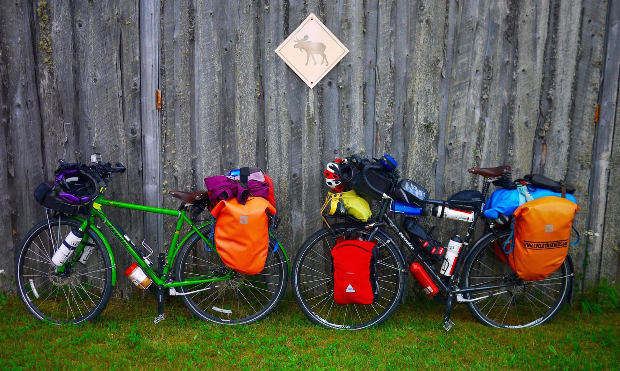
High bike theft in Vancouver. Keep an eye on your bikes.
Hwy 99 southBusy. Good, wide hard shoulder.--There are plenty of cycle paths in Vancouver. You can easily hop on a cycle path to get near the outskirts of the city or onto the 99.
** Another option: Hwy 99 North (Sea to Sky hwy). I’ve only driven this route, never cycled it, but it is absolutely stunning. The route will take you through Squamish, Whistler, Pemberton, Lillooet. You can then make your way to Kamloops from there (I’ve never been on the road between Lillooet and Kamloops so can’t comment on the condition).Busy! Good road with a wide hard shoulder for the most part. The hard shoulder does narrow in sections. This route is more mountainous than the route we took, so expect more mountain passes to cycle. It is also slightly longer.There’s a pretty cool campsite at the bottom of the Chief in Squamish. Good spot for hiking (if your legs are up to it).--
Cut across to hwy 15 and onto 4 ave, which leads to 0 ave (I would instead recommend getting on 8 ave from hwy 15, and cutting down to 0 ave around 200 st or staying on 8 ave the rest of the way).Once on 0 ave, less traffic, small hard shoulder. A few hills from hwy 15 to 200 st.--If you stop on 0 ave, you may have the border police check up on you. They tend to be pretty friendly though. There are a lot of cyclists on that road.
8 ave, Vye Rd – follow to Yarrow Central Rd/ Vedder Mountain RdHard shoulder and good road. Moderate traffic.Wild camping anywhere along the river off Vedder Mountain Rd (before Chilliwack).--
Vedder Rd to Prarie Central Rd onto hwy 1 at Annis RdQuiet road with hard shoulder--Be-careful with your bikes in Chilliwack. High bike theft in the area.
Hwy 1 to HopeVery busy (esp. during holidays). Wide hard should and good road.--Save on Food supermarket in Hope has powerpoints, a picnic tables and free wifi outside. (We’ve discovered that a lot of the big supermarkets have free wifi and a picnic table)
Kettle Valley Rd/Trail (from Hope town to Othello Tunnels)Lot’s of people walking the trail. Gravel through the tunnels (sign telling you to walk the bikes through, but only at the entrance to the tunnels, on the ar park sign). Muddy if there’s been rain.--They filmed Rambo at the Othello Tunnels.
Tunnels Rd/ Othello RdQuiet road. Small hard shoulder. Good surface.----
Hwy 5 (Coquilhalla Summit 1225m)Busy road. Lot’s of trucks and RVs. Wide hard shoulder and good road. Steep 5km climb. Lot’s of chain up areas and a services area at the top of the summit.Lot’s of pull off points on the hwy with possible wildcampingCan cycle around the outside of the Great Bear Snow Shed, instead of through it.
Coldwater Rd to MerritQuiet road. Hard shoulder. Good road.--Free wifi at Walmart.
Hwy 5A to KamloopsModerate traffic. Hard shoulder. Good road.Good wildcamping spots around Stump Lake--
Hwy 5 to ClearwaterBusy. Good road. Hard shoulder.
From Clearwater it’s a very gradual incline to Jasper (we barely noticed it).
----
Hwy 5 to Blue River

(Messiter Summit approx. 850m – nothing to be worried about.)
Busy. Good road. Hard shoulder.Not too many wildcamping spots on the way to Blue River - due to the marshes. Also, lots of bears around Blue River and that general area. There is a campsite in Blue River (apparently overpriced). We were invited to camp in someone’s garden in the town.Not too many places to fill up water along this route. The guy at the garage in Avola is a grumpy man and he won’t let you fill up your water bottles, even if you buy something. Apparently the people at the burger place (Log Inn & Pub) in Avola, just around the corner from the gas station (down the hill) are super friendly, and will probably help you out.
Hwy 5 to Tete Jaune CacheBusy. Good road. Hard shoulder.Not much between Blue River and Valemount.Valemount is a cool town with lots of services (including a brewery & Swiss bakery).

Free wifi at the A&W/ gas station in Valemount.
Hwy 16 to Alberta (and Jasper National Park)As you would expect – super busy! Hard shoulder, though it’s very narrow at times (usually during the uphill sections where there are steep drop-offs).
There are a few steep inclines on the way to Jasper – the first starts just passed Mt Robson visitor centre.
We stayed at the official campsite in Mt Robson ($28 per night), but I think you could get away with wild camping in the BC park (not once you enter Jasper, though).Free wifi at the visitor centre in Mt Robson Provincial Park. Staff were really helpful.
Alberta
Canada cycle route
Hwy 16 to JasperSuper busy. Hard shoulder – bit narrow at times. Good road.We stayed in official campsites only – don’t think you could get away with wildcamping in the park.

Whistlers Campsite ($28 per night) – there are walk-in sites available. It’s about 3km outside Jasper.
We paid for the park pass. We were asked for it 3 times (we were in the park for 7 days). We showed it at Whistlers campsite – though they didn’t actually ask it. No other campsite we stayed at asked for the pass. We probably could have gotten away with just 2-3 day passes – that’s if you’re on a budget and don’t want to pay for the year pass. Also, if there are 2+ people in your group, get the family pass, it’s good for up to 6 people.

Free wifi at the park’s visitor centre in Jasper (we discovered that most national park visitor centres had free wifi).
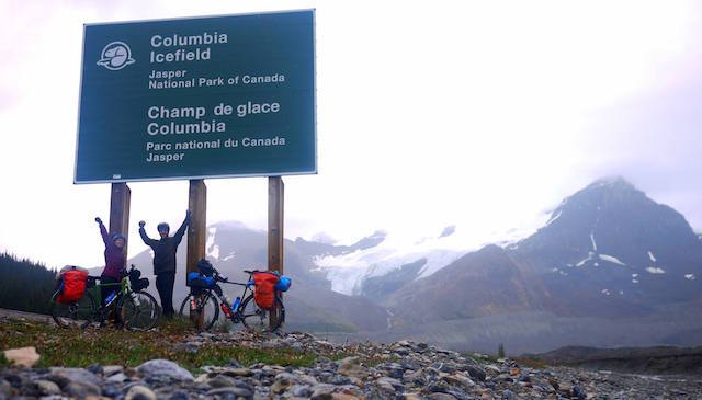
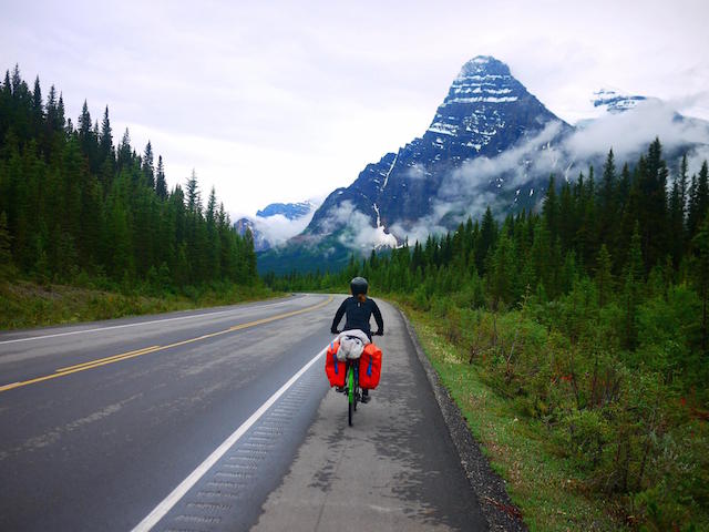
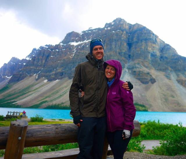
Jasper to Lake Louise (Icefields Parkway hwy 93 & 93A)

2 main passes:
Sunwapta summit & Bow Summit
(You’ll get given a really helpful gradient chart of the entire icefields parkway, when you enter the national park – we found it really good).
93A was really quiet, 93 was really busy. There is a section of the 93 which is in pretty bad condition (coming down Sunwapta pass in the rain was not fun).

From Bow Summit the road is amazing – my favourite day cycling! They are due to repave the whole road but I’m not sure when this will be completed.
Jonas campsite ($15.70 per night) primitive site, but has water. Walk in sites available.

Rampart Creek campsite ($17.60 per night) primitive site, but has water. Walk in sites available – I think Waterfowl Lake would be nicer to camp at (the lake was beautiful). It was fully booked when we cycled pass and I’m not sure if they have walk-in sites.

Lake Louise campsite ($28 per night + booking fee). We booked this in advance as they don’t have walk in sites, and they were fully booked when we turned up. The next closest campsite is over 20km from Lake Louise.

Lake Louise is approx. 4km (up a steep hill) from the campsite and Lake Louise Village.

There are other official campsites along the parkway – not just those mentioned above. They are all included in the map provided when entering the park.
Skip the Icefields Center – tourist trap!

Make sure you check out the waterfalls along the way. Also the hike to the toe of the glacier was worth doing.

Free wifi at the visitor centre in Lake Louise. Also, free (unlocked) wifi near the bakery/ grocery store area in Lake Louise.

The bakery (Laggan's Mountain Bakery & Delicatessen) in Lake Louise Village is highly recommended.
Bow Valley Parkway to BanffBusy road. Good condition. Hard shoulder. We loved this cycle day.There are some official campsites along the parkway if you want to spend the night somewhere. There is also a campsite in Banff.Lot’s of pull outs on the route.

Free wifi at Banff visitor centre.
Banff to Canmore on the Legacy TrailCycle Path along the highway.--There are lot’s of cool ‘bike stations’ with pump, bike stand and tools, dotted around Banff & Canmore.
Hwy 1A to Seebe then Hwy 1 to Calgary

Scott’s Hill (1414m) Summit – a piece of cake after the icefields.
1A quieter road, but narrow hard shoulder. Hwy 1, very busy, but wide hard shoulder, good road. I recommend getting off hwy 1 when you get into Calgary – we didn’t and there were loads of road works, narrow hard shoulder and it was super busy. Try and get onto a road in Calgary with one of the many cycle paths.--Chiniki gas station is one of the only stops along the way – super friendly staff (they let us fill up our thermos). There are a couple of pull outs along the way as well.

MEC in Calgary has an awesome bike section (and free wifi).
Bow River Pathway/ Nose Creek Pathway to Harvest Hills Blvd (heading north out of the Calgary)Cycle path----
Centre St NNarrow hard shoulder (if any). Moderate to busy road.----
567Quiet to moderate traffic. Hard shoulder. Good road.----
Hwy 9 to DrumhellerQuiet to moderate traffic. Good road. Hard shoulder. Not much shade along the way.Camped at the Horseshoe canyon (no official campsite – but there wasn’t any “no camping” signs either).Beiseker was a cute town with a free museum and services (nothing from here to Drumheller).
Hwy 10 (the HooDoo trail), which turns into the 570 at Dorothy.Hard shoulder. Busy road until the Hoodoos, then it becomes very quiet. Road is pretty good condition. Hilly after Coulee community centre.

The cycle to Dorothy is beautiful – then it’s Prairie land the rest of the way.
There is a steep hill just after Dorothy - it felt like it went on and on.
There is a rest stop at Dorothy, which you could easily wild camp at – we didn’t find any water here, but I think you could ask someone in the town (there aren’t any shops/ services in Dorothy). There is a café at the museum in East Coulee (before Dorothy).

We wild camped at the Community Hall in Coulee – homestead Coulee (not much else there except the hall). We asked the workers camping at the site opposite to fill up our water bottles.

Detour at Big Rock (8km return) to visit the trading post. They have free wifi, coffee, free water, food, and are super friendly. There is also a campsite at the lake there (not sure how much they charge).

We also camped in an abandoned building – it looked like cyclists had probably camped there before. It was about 15km before the 886 intersection.
There is not much between Dorothy, AB and Eatonia, SK – so take enough food, and take sufficient water for at least a day or 2 depending on how many km you’re covering a day (there are a few places to fill up along the way, but not really anywhere to buy food).
** Another option is to take hwy 9 from Drumheller into Saskatchewan, but the hard shoulder is apparently quite narrow and the road is really busy. The upside is that there are a lot more towns along the way and the road surface is good. Once in SK head south on hwy 44 and continue on to Eatonia.------
Saskatchewan

canada cycle route
Hwy 44Lots of pot-holes, but the road is super quiet – no trucks allowed. We rode side by side for most of the time we were on hwy 44. There is also a narrow (if any) hard shoulder.Eatonia campsite ($25 per night)

Eston campsite ($10 for the overflow site)
There was no, “Welcome to Saskatchewan” sign on this road, which I was a bit disappointed about.
342Really quiet road and no trucks allowed. We rode side by side, and seen a car once ever 15-30 minutes. There are lots of potholes and no hard shoulder.

There’s a bit of a steep hill just before White Bear.
Hotel in White Bear. Other than that you’ll be camping in farmer’s land if you choose to wild camp in this section.Not much from Eston to Kyle, the White Bear Hotel has good food, free (unlocked) wifi and rents out rooms (it’s closed on Mondays). It’s in White Bear – super friendly community.
** Another option is to continue on hwy 44 all the way to hwy 4 then head south from there to Swift Current. The road is busier and it's a longer route, but there are more services along the way.------
Hwy 4 to Swift CurrentBusy (esp after being on the quiet roads). Lot’s of trucks. Hard shoulder – narrow at some points. Lot’s of potholes and broken bits at the side of the road (the road seemed better around Kyle and the Landing and got worse towards Swift Current).
A bit of a steep incline coming out of the Landing.
Campsite at the landing provincial park (not sure of the fee).

There’s also a hotel in Kyle (has wifi and cheap breakfast).
The library in Kyle has wifi (when it’s opened).
Hwy 1 to Regina.
I really enjoyed this section of the trans-canadian hwy 1.
Wide hard shoulder. Good road surface. Moderate to busy (lot’s of trucks).Visitor centre/ museum in Herbert offers camping for donation. They have wifi and good priced snacks and coffee, and really friendly staff.

$10 camping in Chaplin.
Towns/ services approx. every 20km from Swift Current to Moose Jaw, then only at Belle Plains from Moose Jaw to Regina.

Best bike store in Regina is Dutch Cycling.
Hwy 33 from Regina to StoughtonBusy near Regina, but the road becomes quieter the further you get from the city. Quite a few trucks on the road. Road is very patchy – good in sections, bad in others. Good to narrow hard shoulder. Fillmore (first night free camping – primitive site).

Creelman campsite $15 – washrooms and showers available.

Stoughton also had hotels, motels and a campsite.
This is where we discovered most town halls have a public library that offers free wifi (as well as toilets and water).

Registration for most town (municipal) campsites is at the town hall.
Hwy 13 to the Manitoba borderWide hard shoulder. Moderate traffic.
The road is in good condition until Redvers then the road quality changes to pretty bad (lots of potholes and a narrow hard shoulder), but we hardly seen any traffic on this section of road.
Redvers campsite $10 – register at visitor centre. Visitor Centre has free wifi and a cyclist logbook.

Arcola also had a campsite (not sure of the price).
--
Manitoba

Flag of Manitoba
Hwy 2 to DeleauHard shoulder is gravel (this is normal for Manitoba). Quiet road. Free wild camping in Deleau (toilets, picnic tables and water available).Don’t expect a hard shoulder on a road in Manitoba unless it’s highway 1 – it’s a “Manitoba thing” I’ve been told.

There is a small “Welcome to Manitoba” sign on this road.
Hwy 21 to HartneyNo hard shoulder. Good to average road. Quiet road – even in the town.Campsite in Hartney $10 (avoid if it’s the town’s annual festival – the campsite will turn into a nightclub until 4am and you won’t get any sleep).Wifi at the library in Hartney.
** Alternative Route: If you want to go to Winnipeg then you can stay on hwy 2 all the way to Winnipeg. Hwy 2 will be busier and still have no hard shoulder.------
Hwy 23 which you can take all the way to Dufrost (via Morris).

After Dufrost you can take highway 59 south to the 201 East.
No hard shoulder.
Road quality is patchy and changes constantly.
Bad road around Ninette (hilly).
Good road from Swan Lake to Altamont (there is even a hard shoulder for part of it) – also hilly. Flat from Miami. Quiet road.

Can't comment on the road condition after Morris – see note below.
Campsite just east of Elgin looked like a nice spot (not sure of the price).

You could probably wild camp at the rest/ picnic stop near Dunrea and also just before Miami. There are toilets and picnic tables there.

Campsite at Ninette lake ($22) – popular

Campsite at Belmont ($15)

Campsites at Baldur, Swan Lake and Somerset (not sure of price).

Campsite at Miami ($10)
There seems to be a campsite at every other town.

Roland’s Roadhouse in Roland – owner is super friendly and helpful. Good pizza and wifi.
** We took a slightly different route on hwy 23 to visit a friend at his farm, but our route involves 20km on a gravel road, so I don’t recommend it. In case you’re interested, on hwy 23 we turned south near Kane/ Morris onto a gravel road to our friend’s farm. After visiting our friend we continued south until we reached 14, then we headed East to Rosenfeld. At Rosenfeld we headed south on 30 until we reached 201 East.The 14 was busy. No hard shoulder. Ok road.

The 30 was moderate to quiet. No hard shoulder
----
201 Moderate to quiet traffic to Vita.

After Vita the road is really quiet.

No hard shoulder the whole way. Road quality is ok – patchy in sections.
In Vita you can wild camp at the school (free). There are toilets, but no running water.The owners of Eva’s café in Vita are amazing! Free (unlocked) wifi, free filtered water and cheap food. Highly recommend!

At the intersection with hwy 12, towards Piney, there is a community building on the west side of the road. There is a picnic table and well with running spring water. Ignore the sign – the water is drinkable.
Hwy 12 (This is apart of “Mom’s Way” – an alternative route to the Trans-Canada from Winnipeg to Thunder Bay).Moderate to quiet road. Good surface for most of it. No hard shoulder.We wild camped in the public park at Middlebro (about 6km from the USA border) – picnic tables and a gross public toilet.South Junction gas station has free wifi and picnic tables.
USA: Minnesota
Hwy 11 (Mom’s Way)

Warroad to Baudette (USA stretch – approx. 60km)
There is a small hard shoulder with a rumble strip (you’re forced to cycle on the white line for most of it). The road is moderate to busy. We did not enjoy this section at all!--Williams has a fresh spring well and picnic tables. There is also unlocked wifi at the diner opposite the park (if you eat at the diner - avoid the chips and cheese dip, complete ripoff).
Canada

Ontario


Flag_of_Ontario.svg-2
Hwy 11 (Mom’s Way) Rainy River to Fort FrancesRainy River to Fort Frances there is a small hard shoulder. The road is good quality - for the most part. Quiet to moderate traffic.Wild camped at the rest stop at Sleeman (drop toilets, bins and picnic tables).

Fort Frances campground (pretty gross washrooms and shower block) $17 per night.
Free wifi at Walmart and the visitor center in Fort Frances.
Hwy 11 (Mom’s Way) Fort Frances to Shabaqua JunctionFor most of the road there is a hard shoulder (small to medium). Road quality is generally good – a few potholes/ road works in parts. Traffic is quiet to moderate. Hilly. Overall we enjoyed this section.Wild camped at the Seine River First Nations community (next to the Pow Wow grounds and sports hall). Free wifi at the sports hall – just ask one of the local kids for the password.

Wild camped at the rest stop near Suwapta, about 3km before a diner and the small village. Drop toilets and picnic tables, and easy access to the lake for a swim.

Wild camped at Sabaqua Junction – ask the ice cream van owners where to camp.
There is a long stretch of nothing between the Red Gut gas station and Suwapta diner (approx. 100km).

Red Gut gas station has wifi and picnic tables. The staff were more than happy to fill our water bottles (with ice) for us.

Shabaqua Junction is not a town, but there is a ice cream/ food van there with super friendly owners that love cyclists. They have a great ice cream selection and chill out area. They can also point you in the direction for somewhere to sleep and fill up your water bottles. Great little spot!

Avoid the motel/ gas station about 200m on from the ice cream van - they are not cyclist friendly and won't let you use the wifi (even if you buy something).
Hwy 11/ 17 Shabaqua Junction to Thunder Bay (via Kakabeka Falls)Busy! Road quality is good and has a wide hard shoulder. --Kakabeka Falls is free for cyclists and worth the stop.
103/ Arthur St into Thunder Bay (south)Busy! No hard shoulder for most of the road. Pot holes!

Generally, I didn't find Thunder Bay very cycle friendly.
--Cyclists are prohibited on Hwy 11/ 17 from the 103 intersection (including the section where the Terry Fox memorial is).

We were really impressed with Fresh Air bike store in Thunder Bay.

Tokyo House all you can eat buffet in Thunder Bay is awesome (it's on the south side of the city). Lunch buffet is only about $15.
Take Lake Shore Drive when leaving Thunder Bay (Hwy 11/17 prohibits bicycles until the Lake Shore/ Hwy intersection) Bicycle friendly – medium hard shoulder, moderate to quiet road.Rest stop at Wild Goose Park – potential wild camping spot with beach access!--
Hwy 11/17 to NipigonLot’s of construction work going on (sign states work not to be completed until 2021).

Busy! Lot’s of trucks. Small hard shoulder (bad quality in sections). We did not enjoy this section of the road at all – it didn’t feel particularly safe (we did have constant rain though).
Rest stop approx. 60km north of Thunder Bay – potential wild camping spot (shelter, toilets, picnic tables)!--
Hwy 11

Nipigon to Marathon – stunning!

Superior Lake Provincial Park – even more stunning (cycling through this park was one of our favourite cycle days)!
There were lot’s of road works going on when we cycled. Various different completion dates.

Small to medium hard shoulder (sometimes even a wide hard shoulder, sometimes nothing). Quality varies.

Busy! Lot’s of trucks. More traffic seems to travel West, than East.

Nipigon to Marathon and Wawa to Sault St Marie have quite challenging climbs. Some particularly steep climbs between Nipigon and Rossport (at least 3 climbs). There is also a steep climb coming into Sault.

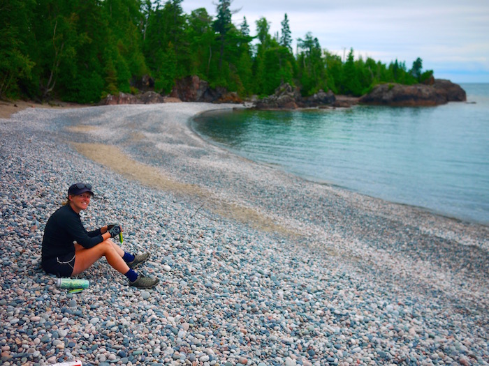
The hard shoulder from White River to Sault St Marie on the east side (the west side didn't look as bad) was terrible! Lot’s of potholes and cracks. At points we had to cycle on the road, and the road is super busy along this stretch.
Wild camped at the rest stop just outside Rossport on the lakeshore (with beach). Great spot!

Potential wild camping at Aguasabon Fall (2km west of Terrace Bay).

We did see someone pitch his or her tent at the visitor centre in Terrace Bay.

Wild camping at Marathon information centre (on hwy 11). Marathon centre is about 4km off the highway.

Manitouwadge turnoff (intersection 614) has a rest stop with toilet.

White Lake Provincial Park has campsites (not sure of the cost).

White River – you can camp at the picnic area next to the tourist information (watch out for bears in this area). Tourist information has free (unlocked) wifi and toilets.

There is a rest stop about 10km east of White River, which is a potential wild camping spot (toilets and picnic tables – no, ‘no camping’ sign).

In Wawa you could try wild camping at the lakeshore – there are no ‘no camping’ signs, and RVs stop there for the night, however the visitor center did advise us that occasionally tenters get moved on (it depends who is patrolling that night). Otherwise, there are wild camping spots by the river (Michipicten River) about 6km south of Wawa.

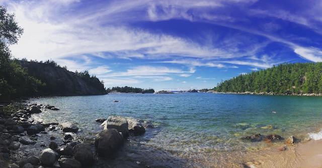
Lake Superior Provincial Park is stunning! Don't skip Old Woman Bay (potential wild campsite) and Katherine's Cove (potential wild camping spot). It is a provincial park and these aren't official campsites so there is a chance you might get moved on, but I think generally it's pretty relaxed. We camped at Sinclair Cove, which was beautiful, but it's a 1.5km detour down a steep road. There is also an official campsite in the park at Agawa Bay, and backcountry campsite available. The closest backcountry campsite we could find to the highway was only 200m, but I wouldn't recommend it unless you have a mountain bike or don't have much gear. The site is at Barrett River (the ranger recommended it to us, but it was too much hassle with the bikes/ bags).

Wild Rose RV park in Batchawana offers free camping for cyclists. The Voyagers nextdoor, apparently has the best apple fritters in Ontario.

Velorution Bike Store in Sault St Marie has a free cyclist campsite (closed on Sundays, but the campsite is out the back. You can text the owner for the washroom code).
Hungry Moose just west of Schreiber is cyclist friendly. Reasonably priced, big portions, good food, free wifi.

Esso garage at Terrace Bay has free (unlocked) wifi.

We discovered that the Husky gas station has a loyalty program, which is free to join up and gives you 500 free points (50 points gives you a free shower, 130 points gives you a free coffee). Husky in White River is right next to the tourist information – perfect place for a shower before pitching your tent. They also have free wifi – when it works!

Wawa visitor center has very good wifi. No camping allowed at the visitor centre. There are no services/ shops for at least 160km south of Wawa.

Canadian Carver - huge tourist trap! Crap wifi! The Voyagers also has crap wifi!
John Rowswell Hub Trail: bike trail around Sault St MariePay attention to the markers and pick up a map - it's easy to lose the trail.

Pretty neat idea, and really well developed around the waterfront.
--Starts next to Velorution bike store (free campsite).
Leaving Sault St Marie on Hwy 17No hard shoulder. Super busy road with lots of trucks.----
Hwy 17BQuiet to moderate traffic. Small hard shoulder.--The world’s largest loonie is on this road, next to a nice picnic spot.
Hwy 17 to just before Sudbury (Whitefish turn off).Super busy, truck road. Small hard shoulder.

The highway between Espanola and Sudbury is particularly bad. There is no hard shoulder at times. We ended up cycling on the gravel shoulder, which isn’t particularly safe as it’s really soft, but the road was too busy to cycle on. This was probably the un-safest section of road we’ve cycled on so far in Canada. There are also a lot of cracks and potholes along this section of road.
Iron Bridge visitor centre/ museum/ picnic area allows camping. We left a donation for letting us camp there.

It’s possible to camp at Spanish near the Marina. There is also free wifi at the marina building, and washroom, shower and laundry facilities.

Potential wild camping at the picnic site approx. 20km east of Espanola.

There are quite a few official campsites along the highway, all seem to charge about $34+ a night for an unpowered, tent site.
This is Amish country, and there are quite a few farmers markets, and fruit and veg stalls along the highway. Most of them seemed to be Amish owned. We also saw some horse and carriages on the road (Thessalon and Iron Bridge seemed to be the most noticeable Amish area).
Road 55

(You can follow this road all the way into Sudbury if you are planning on heading into the city, otherwise you can get back on hwy 17 to go around the city).
No hard shoulder. Quiet road. Potholes (road 55 felt safer than the section of hwy 17 we were on just prior).----
Leaving Sudbury: Bancroft Drive to ConistonCycle path for part of the way. No hard shoulder for the other part. The road is generally really quiet (less stressful than the highway). Some potholes.----
Hwy17 After Sudbury the road quality improves. The road is still really busy, but less cracks/ potholes and a more constant (small) hard shoulder.

Rumble strip on the hard shoulder about 20km east of Mattawa, until just before Deep River (apparently, this is something that’s going to become more common in the area).
Potential wild camping at the picnic spot approx. 30km east of Sudbury.

Wild camping at the picnic/ scenic lookout 20km west of North Bay (we camped behind the toilet block).

Potential wild camping spot at the picnic spot 15km east of Mattawa.

Wild camping at the picnic spot (next to the lake) 45km east of Mattawa.
The New Ontario Brewing Company in North Bay has good beer!
** Coming into Ottawa we took a lot of country roads to avoid the traffic. It was nice and easy (much better than the highway). I’ve included the route below, however it might sound a bit complicated. I’m lead to believe that whatever country road you take into Ottawa will be much nicer than the highway.------
Turned onto Murphy Road towards Petawawa at the Petawawa intersection.Moderate to busy. No hard shoulder. Paved.----
Petawawa Blvd to Pembroke (road changes to Pembroke Street in Pembroke).Bicycle lane on the road! Busy to moderate. Paved.--Loads of Tim Hortons and other fast food places along this stretch. Very built up.
Beachburg Road to Foresters Fall RoadModerate to quiet country road. No hard shoulder. Paved.If you want to detour to the White Water Brewing Company (only 6km off Beachburg Rd), they offer camping for $10 per person.Beachburg is a super cute town. Great community vibe.
Queens Line (changes to Storyland Road)Quiet country road. No hard shoulder. Paved.----
River Road to ArnpriorQuiet country road. No hard shoulder. Paved.----
Old Highway 17Busy coming out of Arnprior, then the road goes quiet. Paved.----
Kinburn Side Road to Kinburn. Turn onto Loggers Way, which changes to Donald B Munro Drive. Follow this road to the town, Carp.Quiet road. No hard shoulder. Paved.--Carp has a picnic area and also a really nice café.
March Road Moderate to busy, with a small hard shoulder. Paved.----
Turn left onto Dunrobin Road (sign posted to Quebec), then turn right onto Riddell Drive, then turn right onto March Valley Road. Quiet roads. Small or no hard shoulder. Paved.

March Valley Road was a nice cycle.
----
Terry Fox Drive (turns into Herzberg Road) to Carling Avenue.Busy. Good road. ----
On Carling Ave you can access the cycle path, which will lead you to Parliament Hill in central Ottawa.Cycle Path (approx. 20km to Parliament Hill). Nice cycle.--This route will avoid all the crazy traffic going into Ottawa. It’s the easiest capital city I’ve ever cycled into.
There are two popular routes from Ottawa to Montreal; 1) the Quebec route along the Ottawa River, 2) the Ontario route. We took the Ontario route because it was slightly shorter. ----We recommend The Cyclery bike store in Ottawa, though there are a lot of other good bikes stores in the city if they don't have what you're looking for.
Ottawa cycle paths to the Prescott-Russell Recreational Trail (ends just after St Eugene at St Eugene Road).72km cycle path. Compacted gravel. Good to cycle on for 95% of the time. Because it is gravel inspect to go a bit slower then on paved road.

We really enjoyed this cycle path.
I think it would be possible to wild camp at the picnic sites along the route. The picnic site at St-Eugene looked like a good option.Picnic tables and toilets along the way.

We didn’t see any water available along the route. There are also no shops, but it’s easy to detour to one of the towns along the route.
St Eugene Road to #10 road (Chemin Comte 10) to Quebec borderSmall hard shoulder. Moderate to quiet traffic.----
Quebec

Flag of Quebec
Chemin du Haut-de-la-Chute road to RigaudModerate traffic. No hard shoulder. Lot’s of cracks and pot holes in the road. Really pretty road next to the river.--Riguad has a good Metro superstore with free wifi.
342Small hard shoulder. Moderate to busy road. Paved.----
Chemin de l’Anse (changes to Rue Main, then to Avenue Saint-Charles) follow this to the bridge at Vaudreuil-Dorion.Shared bicycle/ car road (no separate bicycle lane and no hard shoulder for most of this road). There are some pot holes on the road. When cycling through the towns the cycle path improves. --Really good bakery in Vaudreuil-Dorion (just before the bridge) called “Premiere Moisson.” They also have wifi and really good coffee.
La Route Verte 5 to the locks at Montreal (if you want to get to downtown Montreal)Cycle path on the road. Shared bicycle/ car road at points. Paved. Quiet to Moderate traffic. Quality of the road changes a lot. --The route follows the river. There are lots of picnic spots along the way. There are also lots of services (shops, cafes etc.)
Cycle route along the canal (Du Canal de Lachine) to the old port and downtown Montreal.Cycle path. Paved. Quiet. Nice cycle.--Best poutine in Montreal at La Banquise restaurant (opened 24/7). They also have vegan options.
La Route Verte #5 out of Montreal and over the Norte-Dame Bridge.Mixture of cycle paths and cycle lanes on roads.--Metro supermarket along this route.
138 (which overlaps with Chemin du Roy cycle route and La Route Verte #5 cycle route) to Saint-Augustin-De-Desmaures (just outside Quebec City), once you reach this place make sure you get off the 138 and follow either the Chemin du Roy or La verte route into Quebec City.We ended up just following the 138, as the signage for both the Chemin du Roy and La Route Verte was inconsistent and a bit confusing.

Good hard shoulder for most of the route. Moderate to quiet road.
Not many wild camping spot along this route. The route is pretty “built up.”

There are a few paid campsites available and plenty of motels and B&Bs.

Gîte et Café de la Tour Bed & Breakfast in Sainte-Ann-de-la-Perade, offers free overnight camping in their garden, and optional $10 per person breakfast (incl. coffee) and $10 per person for shower/ washroom facilities.
Plenty of services along the route (picnic spots, supermarkets, shops, cafes, restaurants, motels, water, public toilets, wifi). A lot of the town’s had free municipal wifi.

The Old Port Markets in Quebec City are worth checking out. The wine and cider samples are quite good and very unique (think tomato wine, ice cider and maple rum).
Leaving Quebec City we had 2 options:
- Ferry – easy, cheap ($3.55 per person), quick, nice view of the city
- Bridge – 20km longer, busy, hectic
We took the ferry. It was great – we definitely recommend this over the bridge.--Buy your ferry ticket before boarding the ferry. When we were there the ferry ran every 10-20 minutes and takes about 10 minutes to cross.
Bike path (La Route Verte #1) to the 132Cycle path. Flat and quiet. Nice view of the river.--Picnic spots along the way.
132/ La Route Verte #1 (where we couldn’t cycle on the 132 we followed the Route Verte signs) to Riviere du LoupWide hard shoulder. Quiet road. Well paved - good road condition.

Occasionally the Route Verte was a compacted gravel cycle path, other times it was on the hard shoulder of the 132 or on a quiet road.

We loved this cycle along the Saint Lawrence River. Very beautiful, and relatively flat.
Wild camped at the viewpoint just east of Saint-Roch-des-Auinaies. A stunning spot – right on the river.Picnic spot at the tourist information in Montmagny is a nice spot. The tourist centre has wifi, toilets and drinking water.

The tourist information near La Pocatiere has wifi, drinking water, toilets and good cycle maps, including of La Route Verte #5.
La Route Verte #5 cycle route (135km to Edmunston, NB)Compacted gravel cycle path. Quiet. No cars or motorbikes allowed.Plenty of camping opportunities (approx. every 10km). There are also primitive campsites along the route for $10 per person (self registration).Lots of picnic sites located along the route. Some with drinking water, toilets and shelters.
New Brunswick

flag_of_new_brunswick
Route 144 form Edmunston to Grand Falls (the 144 changes to 108 just before Grad Falls).Small to large hard shoulder. Good paved road. Moderate traffic – busier around Grand Falls.--Nice look out point with picnic tables at Grand Falls.
Route 130 to Perth – Andover

** We did attempt to get on the NB cycle trail (Trans Canadian Trail), but it was soft, rocky gravel. After about 15km the route was closed and we had to detour up a big hill to get back on 130.
Small hard shoulder. The road was patchy in section but generally good. Quite hilly. Moderate traffic.----
Crossed the bridge at Perth- Andover and got on the 105 to Woodstock.

The NB trail does run besides 105. We got on the trail a couple of times, but the gravel was rocky and soft in sections, so we didn’t stay on for more than 15km at a time. It is definitely flatter on the NB trail.
Quiet traffic. Busier around the settlements (particularly near Bristol). Small hard shoulder – sometimes no hard shoulder. Very hilly – if you struggle with constant ups and downs then take the NB trail.--Hartland has a nice picnic spot near the world’s longest covered bridge.

Woodstock seemed a bit sketchy, especially around the Tim Hortons.
Crossed over the bridge at Woodstock and got on the 103 to just before highway 2Moderate traffic. Small to wide hard shoulder. Road quality changes, but generally good.----
NB trail (Ritchie Road to Pokiok Road) - to avoid getting on the highwayQuiet road. Lots of potholes and cracks in sections. Road leads to a suspension bridge. Nice cycle.Wild camped at the picnic spot next to the suspension bridge. No toilets, but there is a picnic table and water from the river.--
Crossed Hawskskaw Bridge and onto Otis Drive through NackawicQuite road. Small hard shoulder. Good paving.--World’s largest axe is in town.
105Quiet road (after the 605 turn off). No hard shoulder. Patchy paving – ok in sections, bumping in other sections. Hilly!--No rest area until York Centennial Park (really nice toilets, picnic tables, water).
Mactaquac Road (across the bridge)Moderate to heavy traffic. Good paved road.--Cool view of the dam on the other side of the bridge.
102Moderate traffic. Good paved road. Wide hard shoulder.----
Just after the “welcome to Fredericton sign” the trans Canada bike trail starts (look out for the sign).Bike path. Compacted gravel/ paved closer to the city. Quiet. Nice cycle.--We followed the bicycle path to the superstore in Fredericton, then out of the city to Oromocto.
102 to Burton BridgeBusy road. Small to no hard shoulder. Ok paving – a bit bumping in patches.----
105 to just before Jemseg (before the bridge).Busy near the bridge and for about 5km after the bridge, then the road quietens downs. The road has hardly any hard shoulder at first and is a bit bumping, but that also improves after 5-10km. Flat, nice cycle along the river.----
Highway 2

** We were going to get on highway 2 at Jemseg, but 105 was closed before the bridge (the bridge itself was not finished), which meant we had to get on highway 2 before the bridge. Once we were on the highway, and at the bridge, there was a “no bicycle sign.” Bicycles are allowed on the highway, but not the bridge. Not wanting to cycle the wrong way down the highway (plus we had no alternative way to get over the Jemseg) we still cycled the bridge – it seemed find, there is still a decent hard shoulder, and it’s two lane traffic, but the bridge is very long.
Moderate traffic. Busy around the bridges. Nice smooth, paved road, with a really wide hard shoulder.--Nice bakery/ grocery store (attached to the gas station) in Jemseg.
Road 10Quiet road (when we were there, but I image in the high season this road is quite busy with tourist traffic). Patchy road, with a few bumps and cracks. Hilly!A couple of seasonal campsites along the route (lot's of places start to close after Sept).Visitor Centre at the junction (it’s seasonal, so was closed when we were there). There is also a gas station on the other-side of the junction turn off.
Sussex

Took McGregor Brook Road, the 121 (Main Street) through Sussex.
Busy! Lot’s of local traffic and tourist traffic. No inner city bike paths. No hard shoulder. There is a campsite in town, but it is seasonal, as are the campsites just out of town.

Timberland Motel (about 7km outside Sussex on the way to Fundy NP) is cyclist friendly,
Famous for it’s murals!

Outdoor Elements is a really good bicycle store – the guys there are awesome!

Lot’s of supermarkets and other stores just as you enter town.
Post Road (Road 111)No hard shoulder. Moderate traffic. Bumpy, but paved.----
114 to Fundy National Park

(make sure you follow 114 at the turn off for Fundy – it’s hard to miss).
Very hilly! A few 10% gradients. Quite when we were there (the beginning of October), but I image there would be a lot of tourist traffic in summer. No hard shoulder for most of the cycle. Road is patchy and bumping in sections, but as soon as you enter the park the road is smooth, small hard shoulder.There are a few park campsite options.

We stayed at Headquarters, because it’s walking distance to Alma town. The campsite is pretty cool, has coin laundry and even wifi ($20.40 per night in the shoulder season). Register at the kiosk or visitor centre.

There is also a primitive campsite at Wolfe Lake (there is a nice picnic site there as well, with toilets).
Park entrance is $8 a day (or free if you have the discovery pass from the Rockies).

Kelly’s bake store is good. We picked up some great “day old” deals. Also, home to the "sticky bun" - try and get one freshy baked.
915 (the scenic route)

* You can stay on 114 instead, which is flatter. To be honest, I don’t think the views on 914 were worth the detour and hills, but I guess that’s personal opinion.
It’s very hilly! Quiet, but I image this would be busy in the peak season. No hard shoulder. Bumpy road.There is a free campground not far after the turn off to the viewpoint.

There are also a few official campsites and guesthouses along this road.
The scenic viewpoints (including the one with the lighthouse) are about 12km detour off the road.
114Moderate to busy road (I image in peak season this road would be constantly busy). There is no hard shoulder (occasionally passing through towns a hard shoulder or bike lane might briefly appear). Paved road, mostly ok.There are a few campsites around Hopewell Rocks, and plenty of motels and guesthouses.

We stayed at the Hopewell Rocks Motel as it was the closest place to the Hopewell park, which meant we could easily walk down and not have to worry about the bikes. They also have somewhere you can store and lock the bikes.
Hopewell Rocks are worth seeing. We spent the night near the rocks, and then walked down after the park closed to see the rocks at low tide (you can enter the park after it’s closed, it’s just you do so at your own risk – and obviously, you don’t have to pay). It was great; hardly any other people there and the rocks were really beautiful around sunset. Definitely recommend!
Moncton

Bike path just before the bridge at Riverview across to Moncton.
Cycle paths around town (gravel or paved).Hostel and guesthouses in downtown. We stayed at the C'mon Inn Hostel, which was in a good location downtown and they have secure bicycle storage.

Campsites are towards Magnetic Hill (about 8km from downtown)
Pump House Brewery does some good beers.

Mike’s bike store is the cheaper bike store in town.
134Moderate traffic. Road is paved with a hard shoulder near the towns, but otherwise there is no shoulder and the road is bumpy with lots of pot holes.----
133Moderate traffic. Paved road, patchy with cracks and potholes in sections. Not much of a hard shoulder. Occasional cycle lane though towns.--Shediac has a nice picnic area at the visitor centre. Free wifi, toilets, a good view of the lake and the world’s largest plastic lobster.
Highway 15Wide shoulder, smooth paved road, moderate traffic.----
955Quiet road along the coast. No hard shoulder. Paved, good to begin with, gets bumpy with potholes as approaching the highway junction.--Only a gas station/ general store along this route.
Highway 16 to the Jourimain Island visitor centre (before the bridge).Wide hard shoulder, smooth paved road, moderate traffic.--Bicycles are prohibited on the Confederation Bridge. There is a shuttle across the bridge, which you catch from the visitor centre ($8.50 per cyclist – but, you only pay if you’re leaving the island). Call the shuttle from a black phone in the visitor centre – then wait until it turns up. We waited 45mins before the shuttled turned up. Shuttle is 24/7, but runs on demand.

Visitor centre has wifi, toilets, picnic tables and a lookout.
Prince Edwards Island (P.E.I)

flag_of_prince_edward_island
Confederation Bike trail to Emerald Junction (road 232)Bike path. Compacted gravel. Nice cycle. Flat.--Lots of picnic tables along the way. A few shelters.
Road 232Paved, quiet, no hard shoulder.----
Mill Road to Highway 2Paved, until half way along the road then it changes to loose gravel for 1km, then changes back. Quiet road. Hilly.

Highway 2 is good, paved, busy, with hard shoulder.
----
Rattenbury Road (road 254)Hilly. Paved. Quiet. No/ small hard shoulder.----
Highway 6 to Cawnpore LaneSmall/ medium hard shoulder, moderate traffic, good paved road.There are a few campsites along this route, but they are seasonal. P.E.I National Park, Cavedish and Green Gables are along this route.

Seasonal route: If travelling this route after Sept, expect a lot of the cafes, shops, campsites, hotels and restaurants to be closed for the season.
Gulf Shore Parkway (this is in the P.E.I national park)Paved cycle path. Beautiful.There is a campsite in Rustico which is open later in the season than Cavendish campsite.

There are also a few wild campspots (if it's low season).
Lot's of view points.
Highway 6Paved. No/ small hard shoulder. Moderate traffic. ----
223Paved. Pretty good road, no pot holes or cracks. Quiet - only local traffic. Hilly.--Nice views of the valley.
Confederation bike trail into CharlottetownBike path. Compacted gravel. Flat. We found the bike trails in PEI really good and well maintained. --Lots of picnic spots along the route. The bike route takes you to downtown Charlottetown. You pass the superstore and a few other shops along the way.
Highway 1 to wood islands and the ferry terminalHard shoulder, rough road with lots of pot holes and cracks in spots, moderate traffic.--Ferry terminal at wood islands has free wifi, toilets and a café. Ferry is $20 per cyclist (you only pay when leaving the island).
Nova Scotia

flag_of_nova_scotia
106Hard shoulder, smooth road, quiet (but dependant on whether a ferry has just arrived).Wild camping spot near Pictou on the Jitney Trail near Brown Point (washrooms and bins).

The Auberge Walker Inn (now called The Scotsman Inn) is a cycle friendly hotel in downtown Pictou (secure bicycle storage and friendly staff).
--
376Decent hard shoulder near Pictou, and a good road (part of the blue cycle route). Quiet to moderate traffic, busier near Salt Springs.Campsite/ picnic site near Salt Springs.--
Highway 4 to TruroNo hard shoulder. Quiet road. Lots of potholes and cracks in the road.Campsite/ picnic site near Salt Springs.
Highway 2 (follow willow street out of Truro) to HalifaxNo hard shoulder or small hard shoulder (for most of the road). Quiet road - busy coming into Halifax, and busy near the major towns. Mostly good, paved road.There are a few picnic sites along the road.* Don't get onto highway 102 at any point - it's a very busy highway with a small hard shoulder.
  • Information on road conditions, prices, campsites, wifi accessibility etc. is valid as of our cycle across Canada trip in the summer of 2016.
  • This list is non-exhaustive (ie. doesn’t include all potential campsites, wifi spots etc.)

Cycling the Alberta Prairies

cycling the Prairies, Cycling the Alberta Prairies

Kelly’s write up about cycling the Alberta Prairies during our cycle trip across Canada in Summer 2016! Click here to read Michael’s write up of cycling across the Prairies.  

A couple of rest days in Calgary and then a couple more in Airdrie was exactly what we needed before Cycling the Alberta Prairies! We had the chance to rest, clean our gear, buy new gear, replace some broken and lost things, eat a whole lot of food and drink a whole lot of beer. So, as you can image we were feeling a bit more ‘normal’ and more enthusiastic about the cycle ahead!

Horseshoe Canyon and the Start of the Prairies

Once we left Airdrie the Prairies became quite apparent. Suddenly there were yellow canola fields, pastures, meadows and wheat farms everywhere. The land also flattened out – though there were still a lot of small hills along the way (which we weren’t expecting). The wind picked up and we spent the day battling a strong head wind. The first of the trip, but not the last.

We spent the night camping in Horseshoe canyon – a stunning canyon just outside Drumheller. It was at Horseshoe canyon where we started to see Prairie Dogs (this is actually where we spotted the most Prairie dogs of the whole trip). Prairie Dogs are totally adorable! They are Canada’s quokkas. A quokka is a marsupial found on an island just off the coast of Perth and they are the happiest, little fur ball in the world, and totally adorable!

quokka selfie
My cousin with a quokaa
prairie dog, Cycling the Alberta Prairies
Prairie dog at Horseshoe canyon, which we discovered while cycling the Alberta Prairies

[ctt template=”8″ link=”nD8hL” via=”yes” nofollow=”yes”]Prairie Dogs are totally adorable! They are Canada’s quokkas.[/ctt]

Drumheller: The Dinosaur Town

In the morning we cycled onto the tourist town, Drumheller. To get to Drumheller we had a steep descent into the Coulee. It was an awesome and very pretty cycle! It also meant we smashed out 20km in less than an hour.

Drumheller is famous for it’s dinosaurs. As soon as you enter the town you will start to see plastic dinosaurs everywhere. We headed straight to the visitor center to see the world’s largest plastic dinosaur. It was actually pretty awesome! You could even pay to climb up to the mouth of the dinosaur. I have to admit, I am a fan of the various, “world largest” items.

We spent a bit of time chatting to the lady in the visitor center and mapped out a plan. We decided to head down highway 10 to check out the Hoodoos (rock formations on a smaller scale to those in Cappadocia, Turkey) and then cycle the quiet 570. Before we head off down this route, we made a quick, but important stop at good ole’ Timmy’s for some sugary treats and a coffee.

The Hoodoos

Highway 10 was stunning, though quite touristy. We cycled through the coulee (like cycling in a gorge or narrow valley) for most of the day. The Hoodoos were quite cool – worth the stop! Not as impressive as the rock formations we seen in Turkey, but still completely different to anything we had seen in Canada so far.

After the Hoodoos the traffic disappeared. There were still a couple of small towns we cycled passed, but we knew we would get to a point that this would end. At the end of the Coulee, in the very small town of Dorothy, we stopped in the shade and had a long rest.

Chilling with the dinos at Drumheller

Road 570: Entering the Prairie Plains!

From Dorothy there was 300km until the next town, which was also in the next province, Saskatchewan. There were very limited services along the route, so we weren’t sure where we would be able to get water. We decided to take this route due to the lack of traffic. Cycling the Alberta Prairies was challenging!

The first night we camped at a community hall in Coulee. Coulee consisted of a farm, a community center/ school (which didn’t look like it was being used) and a camp of construction workers. Luckily this meant we could fill up out water at their camp.

The next day was shit! Strong headwinds, lots of mosquitos, little change in scenery and lots of bloody hills (I thought the Prairies were flat – what I friggin’ lie). To fill up our water bottles we had to detour off the road about 6km to the trading post at Big Rock (Big Rock consisted of a trading post, a house and a campsite). The trading post was like an oasis, with cold drinks, hot drinks, free wifi, free water and friendly staff. I didn’t want to leave. I would have happily lived there for the rest of my life instead of getting back on the 570, but unfortunately, that wasn’t an option.

Haunted Shacks and Ghost Towns

We headed back to the 570 and continued towards Saskatchewan. Finally, we got a nice long descent. When I reached the bottom, I turned around to see where Michael was and noticed a huge black storm cloud was making its way for us. Fortunately, there was an abandoned house in the field, so we decided to head over and check it out.

SASKATCHEWAN ON TWO WHEELS
Where we slept for the night

Now, anyone that knows me would also know I’m a big wimp. I hate anything that could potentially be haunted, I hate scary movies, I hate all that horror crap! I was not planning on sleeping in an abandoned house that looked like it hadn’t been lived in for 50 years. Michael must have been able to tell, just by looking at me that I wasn’t too impressed with the idea. Every horror movie I had ever watched that featured ghosts or haunted houses, started to go through my head. How the hell was I going to sleep in that shack?
Fortunately (or unfortunately), the storm hit! It was bad. Later we learnt just how bad it was – roads had washed out, farms flooded and some areas even got hail. We had no choice but to camp in the haunted shack (by this time I had already decided it was haunted). Surprisingly, I had a good sleep. The storm distracted me from the sounds from the ghosts, that along with being so exhausted from cycling in a headwind all day, meant I passed out pretty much as soon as my head hit the mat.

[ctt template=”8″ link=”mg5c8″ via=”yes” nofollow=”yes”]The storm distracted me from the sounds from the ghosts[/ctt]

Cycling the Alberta Prairies

In the morning we woke to clouds, but the storm has pass. We managed to get some pretty awesome photos in the shack. I was in shock that I actually managed to sleep in a haunted shack – something to tick off the bucket list!
We packed off and got back on the 570 to the Saskatchewan border. We may have finished cycling the Alberta Prairies, but really the Prairies had only just begun!

Are you planning your own cycle tour? If so, check out  this article about Accommodation Options for Cycle Tourists.